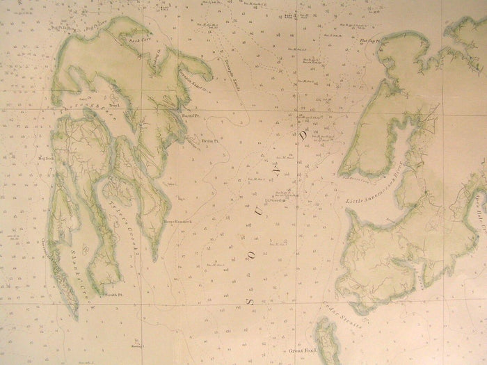
Chesapeake Bay Potomac River to Pocomoke Sound 1859 U.S.C.S. old nautical chart
Chesapeake Bay Potomac River to Pocomoke Sound 1859 U.S.C.S. old nautical chart
BUNDLE & SAVE
Couldn't load pickup availability

Chesapeake Bay Potomac River to Pocomoke Sound 1859 U.S.C.S. old nautical chart
⏱️ Fast shipping
⏱️ Fast shipping
We offer tracked and insured shipping for all of ourorders.Order processing takes 1-3 business days before shipment.
↩️ Free returns
↩️ Free returns
If you're not satisfied, return it for free-no hassle, norisk.
Preliminary Chart of Chesapeake Bay from the Potomac River to the Entrance to Pocomoke Sound
(North America- United States- Nautical Chart- Maryland- Virginia- Sailing Directions- Lighthouses)
Printed 1859, Washington by U. S. Coast Survey under A.D. Bache
Original mid- 19th Century lithograph coast chart map.
Map has been expertly clean, lined and hand colored for a superior visual appearance and is scarce thus. Map retains blank margins all around as issued.
A detailed, scarce and interesting early nautical chart which could readily be collected on it's own merits, displayed or given as a present.
In lovely clean antiquarian condition, paper slightly brittle but mostly clean and sound overall, light minor age dustiness or light surface wear, small scattered spotting or age soiling as seen, original fold-lines as issued which have now been flattened, overall the map is visually attractive --
Please inspect photos closely- any noteworthy flaws to the printed surface area should be noticeable within pictures provided. These pictures form a central part of the item description and we encourage you to study them carefully. We will send the actual antique item shown.
[ note: We grade very conservatively. We are doing our best to show & describe this item so you are happy when it arrives ].
An interesting antique printed map that any collector, dealer, institution or person of taste would be happy to own or display.
Sheet measures c. 38 1/2" W x 26 1/8" H.
Engraved area measures c. 37 5/8" W x 24 7/8" H.
[R4484-rolled]
Guthorn, United States Coastal Charts, p. 9, etc .