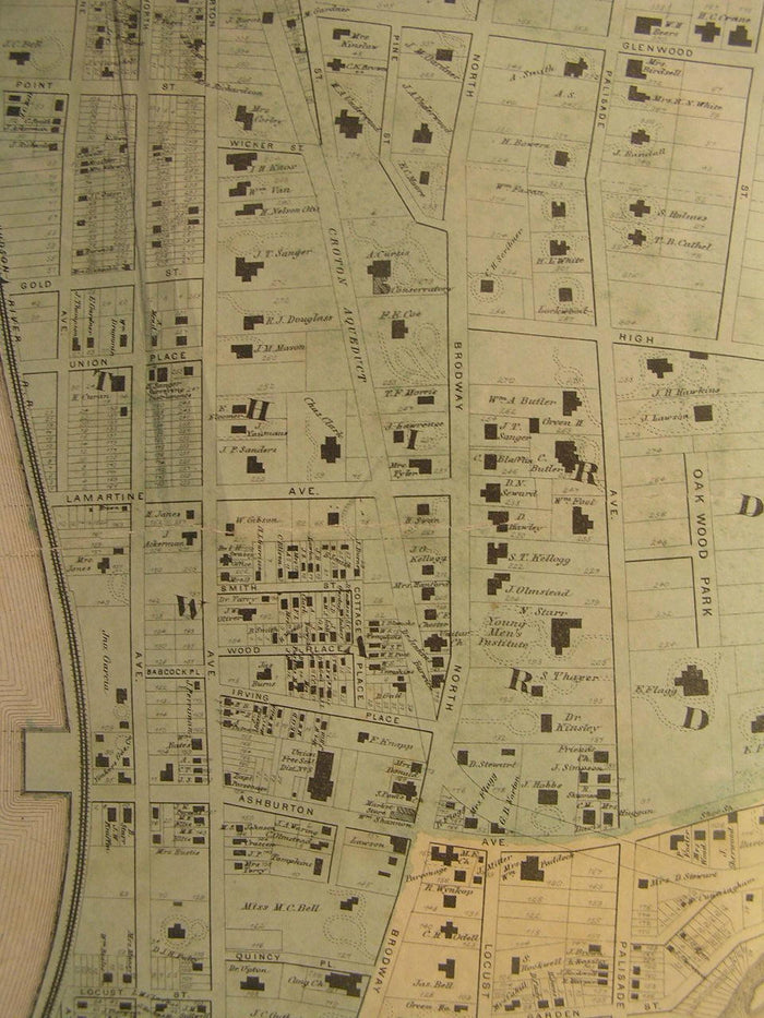
Yonkers Westchester County New York ca. 1870's Huge antique city plan hand color
Yonkers Westchester County New York ca. 1870's Huge antique city plan hand color
BUNDLE & SAVE
Couldn't load pickup availability

Yonkers Westchester County New York ca. 1870's Huge antique city plan hand color
⏱️ Fast shipping
⏱️ Fast shipping
We offer tracked and insured shipping for all of ourorders.Order processing takes 1-3 business days before shipment.
↩️ Free returns
↩️ Free returns
If you're not satisfied, return it for free-no hassle, norisk.
Plan of Yonkers, Town of Yonkers, Westchester Co., N.Y.
(Saw Mill River, Oak Wood Park, North Broadway, Hudson River Railroad)
No imprint, but almost certainly ca. 1870's era.
Lithographed with original hand color.
Fine and very uncommon monumental old city plan of Yonkers, New York. Stunningly detailed, virtually every plot outlined and named if owned, with hundreds of buildings shown. Printed on a bond paper which is rather sturdy.
A picture is worth a thousand words. The photos are a major part of the item description. Please examine them closely, as what you see is what we will send you.
[note: we grade conservatively and always seek to disclose any noteworthy flaws.].
Map remains visually attractive and relatively well preserved. There is a long 12" tear across the map at approx. the middle of the top left quadrant which someone closed with linen tape. This tear is ever so slightly visible, but the closing has been done carefully and the overall visuyal effct is that it is very easy to loverlook or possibly even miss on casual observation. Some light age wear and overall light scattered surface spotting/ soiling which is visible within the pictures (not offensive at all). Certainly not perfect, but entirely acceptable for display or ownership given the scarcity of the item.
Paper and image remains overall clean & sound. Old maps & prints often display small minor repairs on the back, could have uneven blank margins, might have extraneous fold-lines or other small minor age flaws which do not detract from the visual appeal or value. Condition is carefully considered in arriving at our price.
Great antique map entirely worthy of hanging for display.
A depiction captured in a manner entirely unique to this era.
Original fold lines as issued.
Much larger than typical for American city plans of this era.
Sheet measures c. 33 3/4" H x 22 3/8" W.
Printed area measures c. 31 1/2" H x 20 3/4" W
[R1698]